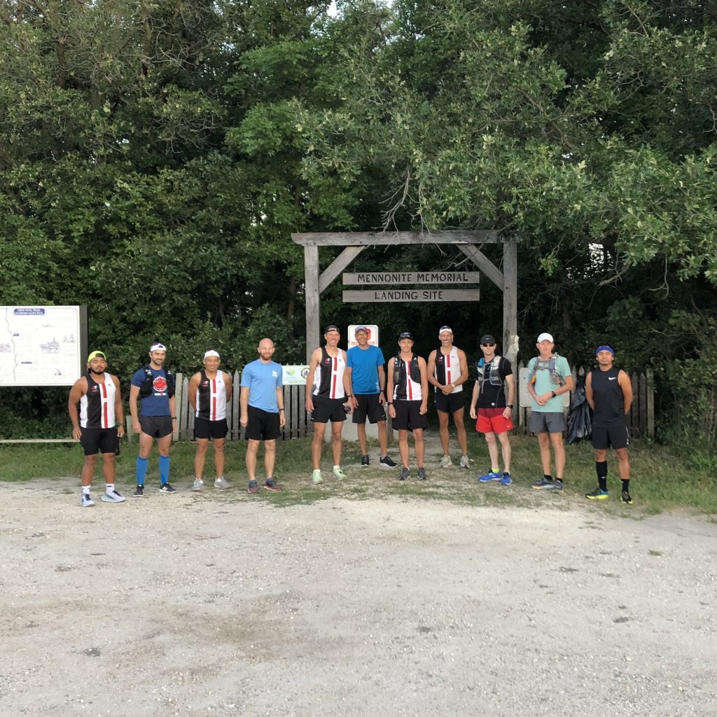
At sunrise on Saturday, August 1, a fisherman stood outside his tent at the point where the Rat and Red Rivers meet. Rod in hand, a curious smirk crossed his face as he watched 11 runners walk down to the river’s edge, dip their toes in the water, then start off running towards the sun.
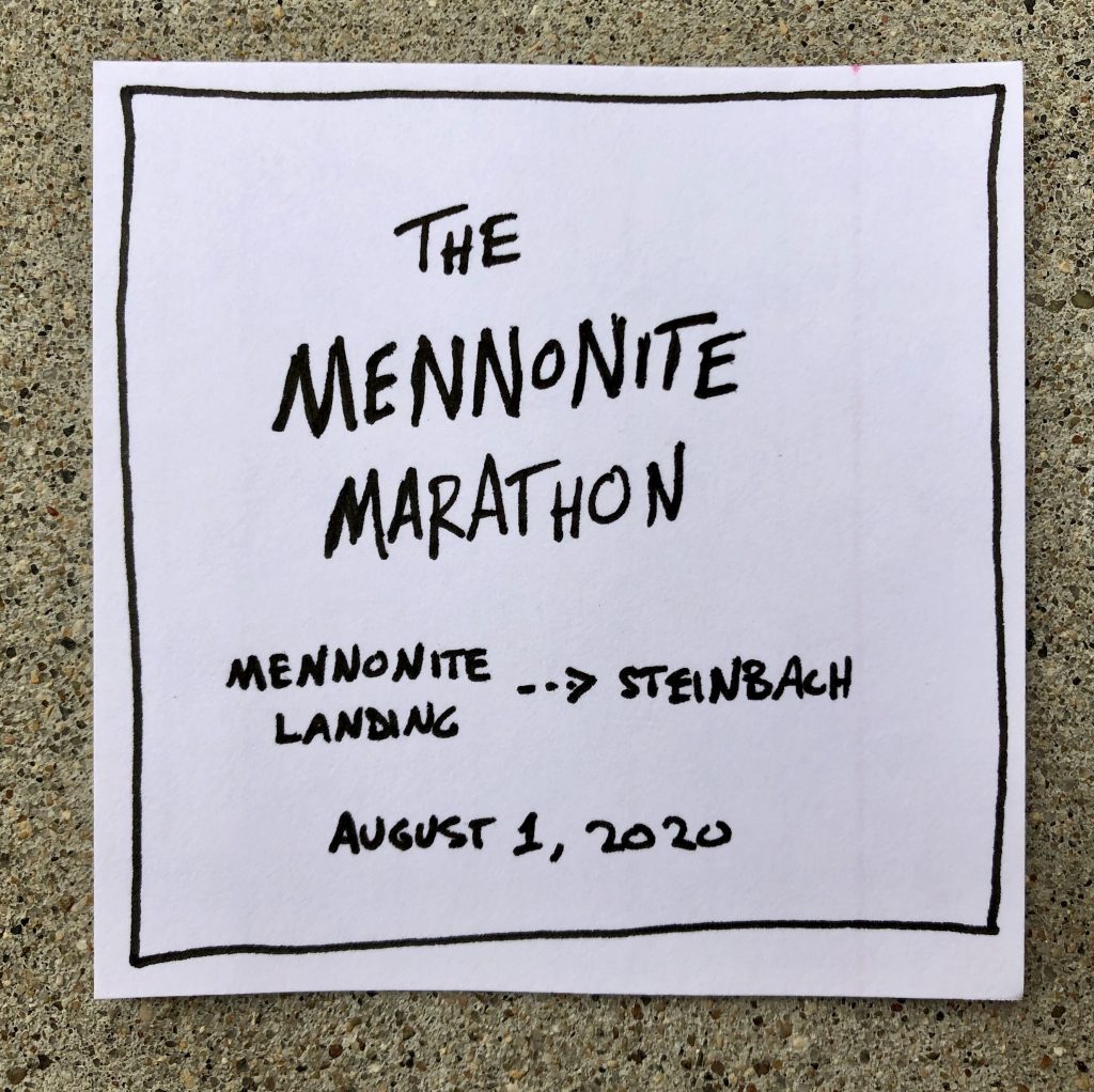
August 1 marked the anniversary of the day when, 146 years earlier in this very spot, the first group of 65 Mennonite families stepped off a steam-powered river boat called the “International” onto the land they would come to call “home”. These families spent their first their first weeks in Jacob Shantz Reception Houses (a mile south of present-day Niverville) until they were able to build other homes and establish communities in the surrounding area. Within the year, communities like New Bothwell (then called “Kronsthal”), Randolph (“Chortitz”), and Steinbach (uh, “Steinbach”) had been settled, forming the foundations of many of communities that continue to thrive today.
Inspired in part by Rickey Gate’s Cross-County Challenge to run across your home “county”, and a recent reading of Cameron Dueck’s Menno Moto, we sought to explore the history of our home region, and have some fun along the way. And when we discovered the distance between the Mennonite Landing and Steinbach was pretty much exactly 42.2km, the distance of a marathon, we knew the route was practically begging to be run.
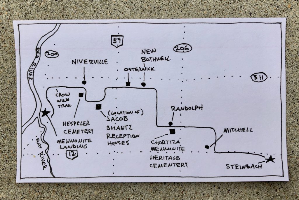
Plotting the route beforehand on Google Maps, it looked ordinary enough. Traversing the grid of mile roads, about 19 miles east, 4 miles south, it would be pretty tough to get lost. The watersheds of the Rat and Red Rivers are notoriously flat, meaning no terrain to cause any roads or fields of crops to deviate from their square patchwork pattern.
But, as always, we found the prairies full of subtle surprises.
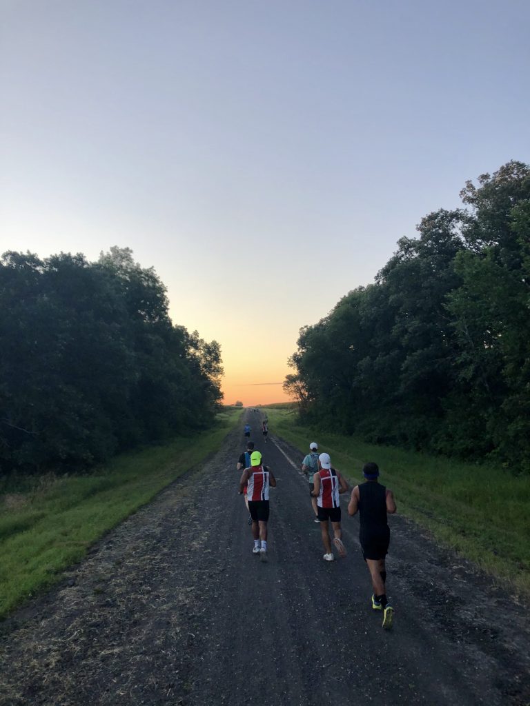
After a short run up the 200 highway, we turned east onto a dirt road which was part of the historic Crow Wing Trail. With corn fields on either side stretching higher than our heads, the road feel more like a trail, and offered a picturesque view of the glowing sunrise.
A few miles later we were scheduled to pass by the immigration sheds (or “reception houses”), where we were told a monument was in the process of being erected. If my running partners expected a running commentary on the history of the area from me, they would quickly be disappointed, as we passed this historic landmark without noticing so much as an up-turned stone.
As we ran, I wondered how this land must have looked before Mennonites arrived. Growing up, the narrative of our homeland started with the arrival of an oppressed group of people searching for freedom and farmland, but what was the story of this land before we showed up on the scene? The immigrant Mennonites, known for their industry, had completely transformed an entire landscape within the span of a few generations. If there had been forests or trees before they arrived, the pieces of evidence were now few and far between.
New Bothwell offered some limestone trails on the side of the highway to mix up the monotony of the gravel roads. Though we could have stopped to snoop around for historic landmarks and the iconic home of Manitoba cheese, we carried on. (I was such a terrible tour guide.)
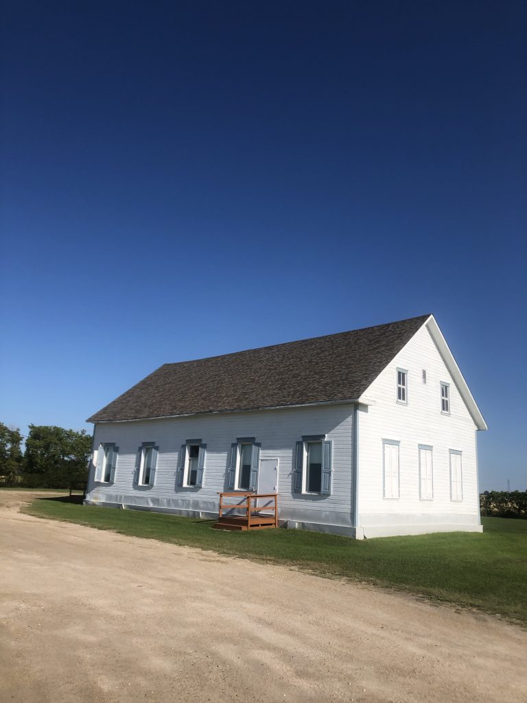
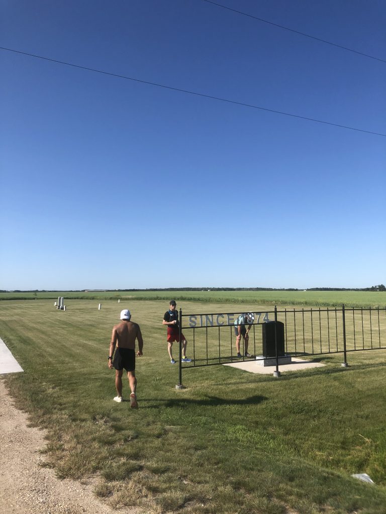
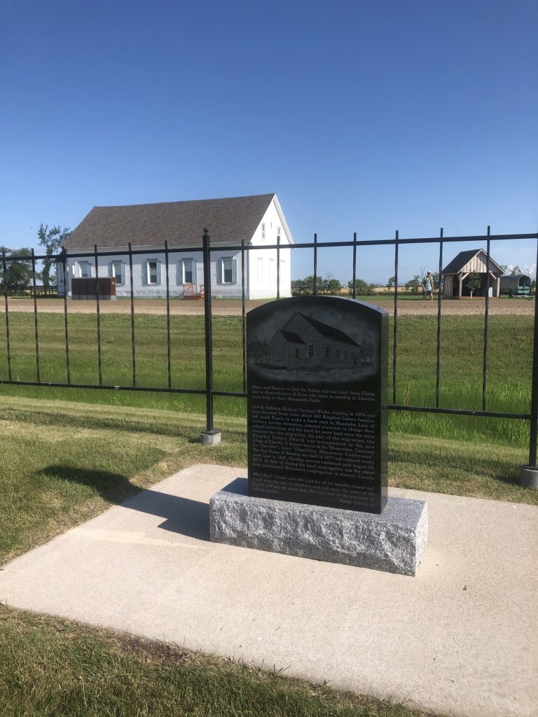
At Randolph we found fulfillment of our curiosities, as we stopped to check out the historic church building and cemetery that was home to ancestors of several of our runners. The cornerstone of the church read “1874-2014”, bringing the history of 146 years quickly forward into the present. Although the building itself was erected in 1897 (causing some confusion about the dates on the building itself), the congregation that met in the building – before dissolving in 2010 – had been the oldest Mennonite congregation in western Canada.
Although we had an established route, several runners modified their path to weave in some landmarks of personal significance. Steffan connected each of his four grandparents’ childhood farms and his parents’ childhood farms, ending up at his own home near Blumenort. Greg ran to several of his grandparents’ graves and their old farmsteads (racking up some extra miles along the way). Although it surely would have been quicker to drive between all these places, and get home before breakfast, tracing the route on foot slowly created a connection with place that can’t be achieved any other way.
As we made our final approach to Steinbach along the busy #12 highway, with tired legs but good spirits, then as we snacked on watermelon and roll kuchen with Roger’s golden syrup (is there any better motivation to run?), we reflected on the long history lying beneath today’s city of industry, asphalt, and the homes of nearly 15,000 people. Our entire crew left the day with a fresh perspective on our home, and a curiosity about the history we share.
Weeks after the run, my wife and I took a stroll through Steinbach, stopping to read some of the plaques describing our little city’s beginnings. At each plaque mentioning the date “1874”, I thought back to the time we dipped our running shoes into the water where the Rat and Red Rivers meet, and the distance we traveled to get from there to here.
With thanks to Erin of Mennotoba for helping with the planning of our route. She’d make a better tour guide than I, you can read some of her discoveries about the area here. And thanks to Greg for helping hatch this idea in the first place. It’s not crazy if you get other people to join you. And to Mae for keeping all of us hydrated along the way. And Anna for making sure we had enough roll kuchen.